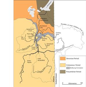


Geologic features of the Athabasca oil sands
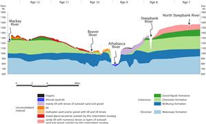
The Athabasca oil sands deposit is the largest Cretaceous oil sands deposit in Alberta, covering an area of about 46,000 km2 (Conly et al. 2002). Most of the bitumen deposits are found in the McMurray Formation, a layer of shale, sandstone, and oil-impregnated sands formed during the Cretaceous period by river and ocean processes. The McMurray Formation, up to 150 m thick, lies over a layer of shale and limestone (the Devonian Waterways Formation) and beneath the Clearwater Formation, a layer of marine shale and sandstone. The Clearwater Formation is itself overlain by the Grand Rapids Formation, which is dominated by sandstone (Conly et al. 2002, Hein et al. 2000).
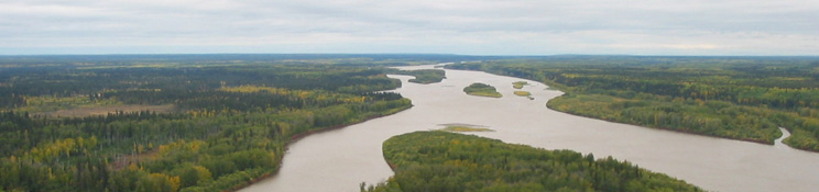
The McMurray Formation overlies a landscape of valleys and ridges. The Formation is almost absent where the Devonian layer rises in a ridge, cutting through the McMurray Formation. North of Fort McMurray the Formation can be found within 75 m of the surface, and is exposed at the surface where the Athabasca River and its tributaries have incised into the landscape. The McMurray Formation is first exposed in the Athabasca riverbed at Boiler Rapids, 50 km upstream of Fort McMurray, and again near the MacKay River (Conly et al. 2002). Oil sands exposed at the earth’s surface are a widespread natural source of hydrocarbons entering the aquatic ecosystems of the area.