


Climate and Hydrology
The physical, chemical, and biological components of aquatic ecosystems are all linked to the hydrology—the pattern of water movement—of that ecosystem. Patterns of water flows and water levels are affected by characteristics of the surrounding landscape as well as climatic factors such as precipitation and temperature. The RAMP Climate and Hydrology component collects data to better understand the human and natural factors that affect the hydrology of aquatic environments in the Athabasca oil sands region.
View general hydrologic characteristics of the drainage basins monitored by RAMP.
The objectives of the RAMP Climate and Hydrology component are to:
- Provide a summary of hydrological conditions for each year relative to previously observed conditions (e.g., historical means or extremes). Because hydrology is so closely linked with chemical and biological characteristics, this facilitates interpretation of data collected by the other RAMP components.
- Collect baseline climatic and hydrologic data on a stream-specific basis, to characterize natural variability and detect any regional trends.
- Collect data for assessing hydrological changes predicted by oil sands EIAs.
- Support regulatory applications and meet monitoring obligations found in regulatory approvals.
- Support calibration and verification of regional hydrological models.
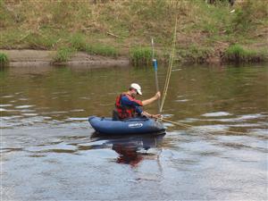
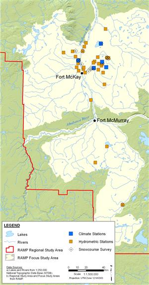
The RAMP Climate and Hydrology component has established several monitoring stations throughout the RAMP study area (see map to the right). At some of these stations, data are collected using automated sensors, while at others, on-the-ground personnel complete field measurements. Variables measured for the Climate and Hydrology component include the following (although not every variable is measured at every station):
- Air temperature;
- Rainfall and snowfall;
- Relative humidity;
- Wind speed and direction;
- Solar radiation;
- Snow on the ground;
- Snow depth and mass (for snow water equivalent and snow density calculations);
- Water level; and
- Discharge.
RAMP Climate and Hydrology data are generally integrated with data collected by other organizations (e.g., government), and are analyzed each year. Hydrographs for each station of interest are constructed from field data. Potential effects of oil sands development on hydrology are examined by comparing these measured hydrographs with the hydrograph that would have occurred if no development was present within the watershed (a calculated, “naturalized” hydrograph). Four specific measurement endpoints are used to assess differences between these hydrographs. These measurement endpoints include:
- Mean open-water season (May 1st to October 31st) discharge;
- Mean winter (November 1st to March 31st) discharge;
- Annual maximum daily discharge; and
- Open-water season minimum daily discharge.
For each station, differences in measured values of these variables from values that would have occurred in the absence of development can indicate a potential effect of development on the hydrology of the watercourse.
For additional information on how the Climate and Hydrology field variables are measured and analyzed, the specific variables measured at each station, and the method used to assess potential impacts (including calculation of naturalized hydrographs), please refer to the relevant sections of the RAMP Technical Design and Rationale report (RAMP 2005) and annual RAMP technical reports (see Monitoring Results). For more general information on climate and hydrology, visit the Climate and Hydrology modules.