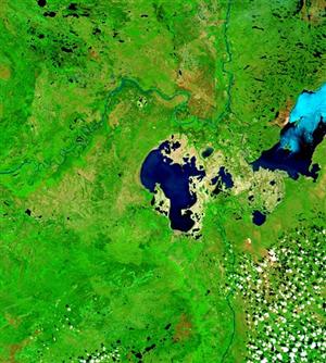


Flooding in the Peace-Athabasca Delta
Lake Athabasca’s drainage basin—including the drainage basin of the Athabasca River—covers an area of about 269,000 km2 in Alberta, Saskatchewan, and a small portion of the Northwest Territories. Major sources of water flowing into Lake Athabasca include:
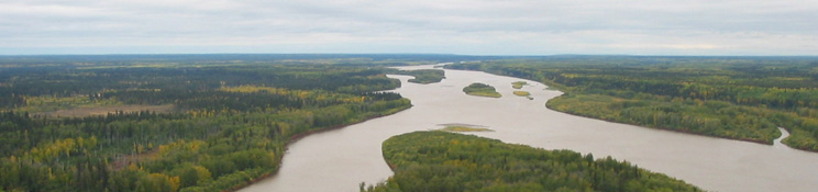
- the Athabasca River, arising in the Columbia Icefield in the Rocky Mountains. The Athabasca River and its tributaries contribute the largest proportion of the annual inflow to Lake Athabasca.
- the Fond du Lac River, arising in Wollaston Lake, Saskatchewan, and flowing through several lakes before discharging into the eastern end of Lake Athabasca. The Fond du Lac River contributes approximately 21% of the total inflow to the lake and delta region (Prepas and Mitchell 1990).
- the Peace River, flowing from Williston Lake, the reservoir created by the W.A.C. Bennett dam in British Columbia, to its delta located northwest of Fort Chipewyan. Water flow from the Peace River to Lake Athabasca is seasonal.
The natural pattern of water movement into and out of Lake Athabasca depends on water levels in the lake and the Peace River, although control structures erected in the 1960s and 1970s have altered the natural hydrology of the lake and delta. For most of the year, water flows into Lake Athabasca through the Athabasca River delta and other tributaries, and northward out of the lake via the Rivière des Rochers and Chenal des Quatre Fourches (PADPG 1972). These two channels join the Peace River to form the Slave River, which flows northward to Great Slave Lake, the Mackenzie River, and, ultimately, the Arctic Ocean. During spring or summer flooding, however, water levels in the Peace River can exceed the water level of Lake Athabasca, causing reversed (southward to Lake Athabasca) flows in the Rivière des Rochers and Chenal des Quatres Fourches. The lack of outflow through these channels combined with high inflows to the lake causes Lake Athabasca to flood westward through the Lake Mamawi-Lake Claire system, filling the channels, lakes, wetlands, and perched basins of the delta (PADPG 1972).
Construction of the W.A.C. Bennett dam in British Columbia and the filling of Williston Lake behind the dam led to low flows in the Peace River from 1968 to 1971. These low flows prevented flooding in the delta, raising concerns about the ecological integrity of the delta in the absence of the annual flood (MRBB 2004, Prepas and Mitchell 1990). Permanent weirs were constructed in 1975 and 1976 on the Rivière des Rochers and the Revillon Coupé, a distributary of the Rivière des Rochers. According to studies conducted during the 1980s by the Peace-Athabasca Delta Implementation Committee, these weirs nearly restored peak summer water levels in the lake and delta, and counteracted many of the impacts that regulation of the Peace River had had on the delta (MRBB 2004, Prepas and Mitchell 1990). The weirs do not affect water levels in the Peace River, however, and perched basins in the Peace Delta that were dependent on regular flooding have been lost (Prepas and Mitchell 1990).