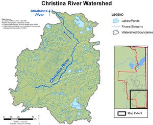


Christina River Hydrological Profile
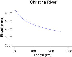
The Christina River, with a drainage area of 13,038 km2, is a tributary of the Clearwater River, and enters the Clearwater approximately 30 km upstream of Fort McMurray. The elevation of the headwaters of the Christina River is about 720 m. The Christina River drains large areas of muskeg as it flows south toward Ft McMurray.
Flows are recorded for the Christina River near Chard (WSC station 07CE002 and RAMP station S29). The drainage area contributing to flows at this location is 4,860 kmSimilar to the Clearwater River, the Christina River tends to experience lowest flows in the winter and mid-summer. High flows generally occur during the spring freshet (flows primarily derived from snowmelt) and during summer through to early autumn due to rainfall events. The highest flow recorded for the Christina River near Chard was 118 m3/s and occurred on June 21, 1991. The lowest recorded flow of 0.91 m3/s occurred on March 16, 1993.
Online Hydrographs
View online hydrographs of the Christina River in the Interactive Features section.