


Ells River Hydrological Profile
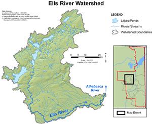
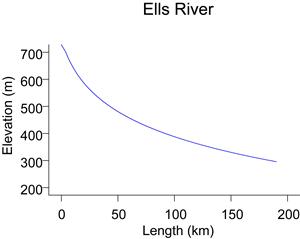
The Ells River originates in the southeast slopes of the Birch Mountains at an elevation of approximately 730 m. The Ells River descends to an elevation of approximately 230 m, and meanders through the boggy landscape of the lower reaches before flowing into the Athabasca River from the west. Seasonal flows have been recorded by RAMP at station S14, Ells River above Joslyn Creek.
Online Hydrographs
View online hydrographs of the Ells River in the Interactive Features section.