Muskeg River Hydrological Profile
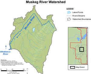
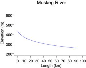
At its confluence with the Athabasca River near Fort McKay, the Muskeg River carries surface water drained from an area of about 1,460 km². Included in this area are the north and west slopes of Muskeg Mountain and the south slopes of Fort Hills. Approximately 55% of the drainage is upland area, with the headwaters at an elevation of approximately 560 m, while 44% is considered lowlands. Roughly 1% of the drainage basin is lake area and much of the lower landscape is dominated by muskeg.
Flows are recorded for the Muskeg River at Fort McKay by WSC and RAMP. WSC provides flow records for the open water season (WSC station 07DA008), and RAMP (RAMP station S7) completes the record by monitoring flows from late October to March. Historic flow records for the Muskeg River include a maximum recorded daily flow of 66.1 m³/s on May 9, 1985. The lowest recorded flow of 0.040 m3/s occurred on January 2, 1984.
Online Hydrographs
View online hydrographs of the Muskeg River in the Interactive Features section.


